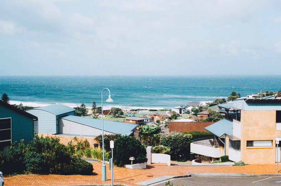
- Duration
- 3 days: the coast, the rainforest and the house museum
- Who it suits
- Everyone
- Transport
- drive
- Start
- Kiama Blowhole
- Finish
- Nowra
- Pace
- moderate pace
- Best time
- put day 3 on a Saturday because of Meroogal
- Budget per adult
- Minnamurra A$12 per vehiclePrices as of: 13 October 2026
Getting there
Day 1 can start on the train to Kiama, then a car: Little Blowhole, Jamberoo and Kangaroo Valley have no station. Day 2 turns west into the mountains. Day 3 is Nowra, where the train ends at Bomaderry station. Jervis Bay, Mollymook and Pebbly Beach start south of Nowra and sit on their own route: allow about an hour by car from Nowra to Huskisson.
Stops in order
The text version of the route: stops, time at each and the legs between them. Times are estimates, without queues, traffic or swims.
Day 1. Kiama and Berry
Day in Google Maps ↗1. Kiama Blowhole~30 min at the stop
The first stop is by the lighthouse. Free, and open at any time, stronger in a south-east swell.
Worth knowing: George Bass was the first to record it: in December 1797 he anchored his whaleboat in the bay now called Kiama Harbour.
Tip: If you came by train, Kiama station to the point is about a kilometre on foot through Terralong Street.
Open on the map ↗↓ drive · 8 min · 3 km
2. Little Blowhole, Kiama Heights~20 min at the stop
The second hole in the rock, on Tingira Crescent. It comes alive more often in a north-east swell.
Tip: A short stop. The column of water is smaller than the one by the lighthouse.
Open on the map ↗↓ drive · 15 min · 12 km
3. Werri Beach~40 min at the stop
The Gerringong beach. The town shops are on Fern Street, just behind the beach.
Tip: Lunch on Fern Street. The train stops in Gerringong if part of the day is without a car.
Open on the map ↗↓ drive · 25 min · 20 km
4. Queen Street, Berry~1 h at the stop
The late part of the day on the shopping street. The Berry Donut Van is at 73 Queen Street, Milkwood Bakery at 109, every day 6:00am to 4:00pm.
Tip: The station is close. If you stay in town, tomorrow can start with the bread, then the drive west to the rainforest.
Open on the map ↗
Day 2. Rainforest and the valley
Day in Google Maps ↗5. Minnamurra Rainforest~1 h 30 min at the stop
The morning is on the boardwalks in Budderoo National Park. A$12 per vehicle, gates 9:00am to 5:00pm. The centre is open until 4:00pm.
Tip: Arrive at opening: between 11 am and 2 pm the centre gets crowded and may close at short notice. The café is shut, so bring food. Phone 02 4236 0469.
Open on the map ↗↓ drive · 15 min · 10 km
6. Jamberoo~25 min at the stop
The village on the way up the hill. A short coffee before the winding road into Kangaroo Valley.
Tip: Check the water park's own site for its season. The village is worth the stop either way.
Open on the map ↗↓ drive · 50 min · 40 km
7. Hampden Bridge~25 min at the stop
An 1898 suspension bridge over the Kangaroo River on Moss Vale Road, Australia's only surviving colonial-era suspension bridge. It's under repair in 2026 but open by day.
Tip: Night closures ended in September 2026. On weekdays until the end of October there's stop/slow control by day. Load limit 23 tonnes. Check livetraffic.com.
Open on the map ↗↓ drive · 5 min · 1.5 km
8. The Friendly Inn~50 min at the stop
Lunch or dinner in the village, 159 Moss Vale Road. This is the end of the mountain day.
Tip: Stay in the valley overnight, or drop to Nowra while it is still light. Meroogal is about half an hour on.
Open on the map ↗
Day 3. Nowra
Day in Google Maps ↗9. Meroogal~1 h at the stop
The 1880s house museum, 35 West Street. Inside, it is a guided tour, Saturdays only, 10:00am to 4:00pm. Entry is free and you need a booking.
Worth knowing: One of its owners, Tot Thorburn, had suitors in the Victorian era but chose not to marry, and lived a long, happy life here with her sisters.
Tip: Put this day on a Saturday and call 02 4421 8150. The Women's Art Prize exhibition runs until 24 April 2027.
Open on the map ↗↓ drive · 5 min · 1 km
10. Nowra~50 min at the stop
Central Nowra after the house. The train from Sydney ends at Bomaderry, on the north bank of the river, and the centre is a few minutes from there.
Tip: If Saturday is taken up by the house, leave lunch for town. South to Huskisson is the other route in this guide.
Open on the map ↗
Before you go
- Route times are estimates: walking, driving and a sensible pause at each stop. Add queues, traffic and swims yourself.
- Prices, timetables and trail status change. Check the venue's official site and the state transport app before you go.
- On beaches, swim only between the red and yellow flags. Use sun protection even when it is cloudy.