- Duration
- 3 days, about 500 km by car
- Who it suits
- Everyone
- Transport
- drive
- Start
- Ayers Rock Airport
- Finish
- Kathleen Springs
- Pace
- moderate pace
- Best time
- April–September
- Budget per adult
- Uluru pass A$38 plus NT Parks A$10 a day; Wintjiri Wiru Twilight from A$210Prices as of: October 2026
Getting there
Fly into Ayers Rock Airport (AYQ): Qantas, Jetstar and Virgin fly direct from Sydney, Melbourne, Brisbane and Cairns. Ayers Rock Resort hotel guests ride a free AAT Kings coach, no booking needed. There are no taxis or public transport in the park, so you need a hire car, a tour or a hop on hop off bus pass. From the resort it is about 20 minutes to Uluru and about 45 minutes to Kata Tjuta.
Stops in order
The text version of the route: stops, time at each and the legs between them. Times are estimates, without queues, traffic or swims.
Day 1: Uluru
Day in Google Maps ↗1. Ayers Rock Airport~30 min at the stop
Land and collect a hire car: Avis and Hertz hand over at the airport.
Tip: Yulara has few hire cars, so book weeks ahead.
Open on the map ↗↓ drive · 30 min · 30 km
2. Uluru-Kata Tjuta Cultural Centre~2 h at the stop
Start with the story: Tjukurpa, the Anangu seasons and the galleries of local artists, Maruku Arts and Walkatjara Art. Grab a bite at Ininti café.
Worth knowing: The mud-brick building takes the shape of the two ancestral snakes, Kuniya and Liru.
Tip: Open daily 7:00–17:45, free with your park pass.
Open on the map ↗↓ drive · 5 min · 3 km
3. Mutitjulu Waterhole~45 min at the stop
The short, shady Kuniya walk, 1 km return, to the permanent Mutitjulu Waterhole and a cave with rock art. It's the setting of the Kuniya and Liru story.
Tip: In the afternoon this is the coolest corner of the rock.
Open on the map ↗↓ drive · 15 min · 14 km
4. Uluru car sunset viewing area~1 h at the stop
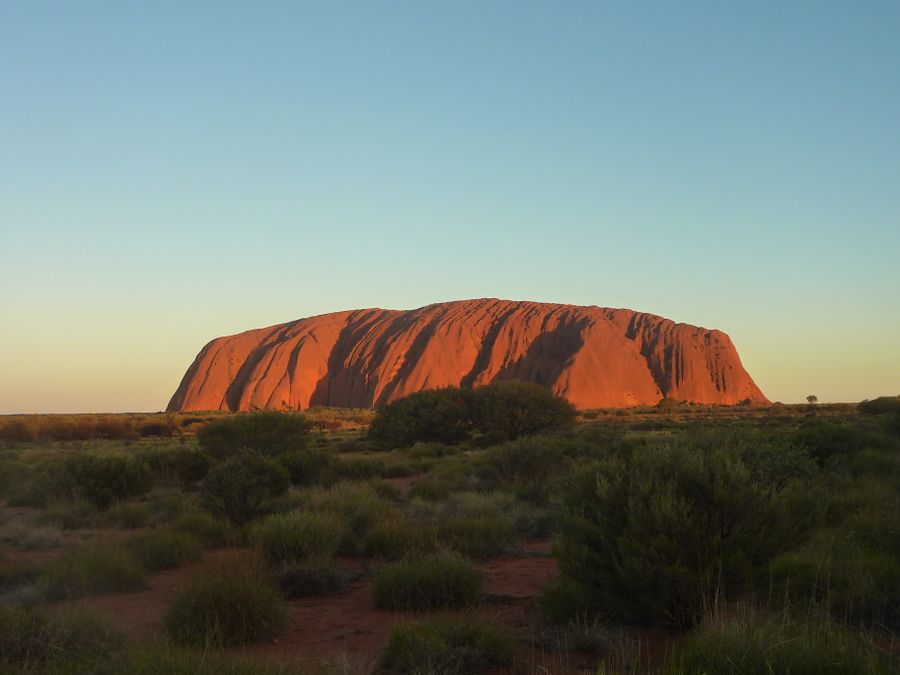
The classic Uluru sunset shot: the sun sets behind you and the rock turns orange, then deep red. The resort is 20 minutes away.
Tip: You can still make Field of Light afterwards: entry from A$50.
Open on the map ↗
Day 2: Kata Tjuta and the drive to the canyon
Day in Google Maps ↗5. Valley of the Winds~3 h 30 min at the stop
The full Valley of the Winds circuit: 7.4 km and 3–4 hours over rocks and steep sections between the domes of Kata Tjuta. Start at sunrise while it's cool; there's water at the start and halfway.
Tip: Anangu ask that you don't photograph the domes on this walk. With a forecast of 36°C or more, the track beyond Karu lookout closes from 11am.
Open on the map ↗↓ drive · 10 min · 6 km
6. Walpa Gorge~1 h at the stop
A level 2.6 km return path between the sheer walls of Kata Tjuta: a short gorge walk before the long drive.
Tip: Refuel in Yulara: Kings Canyon is about 300 km away.
Open on the map ↗↓ drive · 4 h · 355 km
7. Kings Canyon Resort~1 h at the stop
The closest beds to the canyon: rooms, campsites and cabins. From here you can be first on the trail in the morning, before the heat.
Tip: Do not drive at dusk: kangaroos and cattle wander onto the road.
Open on the map ↗
Day 3: Kings Canyon
Day in Google Maps ↗8. Kings Canyon Rim Walk~3 h 30 min at the stop
A 6 km loop, 3–4 hours: a steep climb, then the canyon rim with 100 m walls and the Garden of Eden waterhole halfway.
Worth knowing: The finale of The Adventures of Priscilla, Queen of the Desert (1994) was written for Uluru, but a climb in drag there would have offended Anangu beliefs, so the scene was shot at Kings Canyon instead.
Tip: On days forecast at 36°C or more, start before 9:00 without fail.
Open on the map ↗↓ drive · 20 min · 21 km
9. Kathleen Springs~1 h 15 min at the stop
A quiet finish: a sealed 2.4 km return path to a spring at the end of a gorge, with signs on Aboriginal culture and cattle-station history.
Worth knowing: The spring lies about 21 km south-east of Kings Canyon. The park's name, Watarrka, is the Luritja word for the local umbrella bush, an acacia.
Tip: From here it is 450 km to Alice Springs or about 300 km back to Yulara for your flight.
Open on the map ↗
Before you go
- Route times are estimates: walking, driving and a sensible pause at each stop. Add queues, traffic and swims yourself.
- Prices, timetables and trail status change. Check the venue's official site and the state transport app before you go.
- On beaches, swim only between the red and yellow flags. Use sun protection even when it is cloudy.