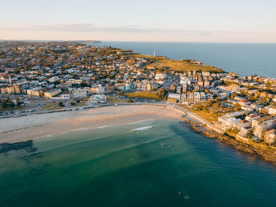
- Duration
- 13.4 km, 4–5 h, ~390 m of climbing (≈ 6 h 35 min: moving and stop time only)
- Who it suits
- Everyone
- Transport
- walk
- Start
- Bondi Beach lifeguard tower
- Finish
- Watsons Bay Wharf
- Pace
- active day
- Best time
- From May to November humpbacks are often seen from the cliffs at Dover Heights and The Gap. In summer start at 7 or 8 am: there is almost no shade on the clifftops. In a strong wind, skip the South Head loop.
- Budget per adult
- free, plus the bus to Bondi and the ferry back (Opal or a bank card)Prices as of: July 2026; transport and zoo prices October 2026
Getting there
Train to Bondi Junction, then bus 333 or 380 to Bondi Beach. Back on the F9 ferry from Watsons Bay Wharf to Circular Quay, or buses 324 and 325 to the city. In strong winds ferries sometimes skip Watsons Bay and turn at Rose Bay.
Stops in order
The text version of the route: stops, time at each and the legs between them. Times are estimates, without queues, traffic or swims.
1. Bondi Beach lifeguard tower~15 min at the stop
The official start is the lifeguard tower in the middle of the promenade. Face the ocean and turn left, north, past North Bondi surf club.
Tip: Toilets and water are at Bondi Pavilion. Fill your bottle: after Ramsgate Avenue there are almost no cafés on the route until Watsons Bay. If you want the coast south instead, that is our other walk, Icebergs to the Bronte pool.
Open on the map ↗↓ walk · 40 min · 2.5 km
2. North Bondi rock engravings~15 min at the stop
Past Ben Buckler Point the route joins Military Road. Opposite Blair Street you can step onto the golf course: 50 m from the road, just right of the old sewer vent, figures including sea creatures are cut into a flat rock.
Worth knowing: The Ben Buckler boulder, about 235 tonnes, was thrown up onto the rock shelf by a storm in 1912.
Tip: It is a short out-and-back; do not walk on the engravings. From Ben Buckler look down at the rock shelf: there is a huge boulder on it.
Open on the map ↗↓ walk · 35 min · 2 km
3. Dudley Page and Rodney Reserves~15 min at the stop
The Waverley clifftop walk reaches Rodney Reserve, and across the road comes the first harbour view: the Dudley Page lawn with the whole city skyline.
Tip: The edge of Rodney Reserve has a playground, a good break with kids. Next, at Eastern Reserve, the clifftop boardwalk is a great place to scan for whales in season.
Open on the map ↗↓ walk · 25 min · 1.6 km
4. Diamond Bay Reserve~10 min at the stop
A timber boardwalk along the cliff and thick green bush in Rosa Gully. The path loops the bay, crosses the creek and climbs to a grassy clifftop edge.
Tip: Stay behind the fence: there is no way down to the water and no swimming here. The gully is the only shade.
Open on the map ↗↓ walk · 20 min · 1.2 km
5. Macquarie Lighthouse~15 min at the stop
The white tower on Old South Head Road, with the signal station and old gun emplacements further along the cliff.
Worth knowing: The first light here was built in 1818, Australia's oldest lighthouse site. The current tower dates from 1883.
Tip: Toilets and a playground are next door in Christison Park. There is little shade, so do not linger in the heat.
Open on the map ↗↓ walk · 25 min · 1.5 km
6. The Gap~15 min at the stop
The path follows the cliff edge through Don Ritchie Grove to The Gap lookouts, then drops to the palms on Gap Bluff Road with a view of the Bridge.
Worth knowing: In 1857 the clipper Dunbar was wrecked below these cliffs: 121 people died and one sailor survived. Her anchor stands in Gap Park.
Tip: Stay behind the fence. Dogs are not allowed in Gap Park. Camp Cove water is about twenty minutes on.
Open on the map ↗↓ walk · 20 min · 1.2 km
7. Camp Cove~40 min at the stop
A calm sandy harbour cove and the first real swim of the day. The wooden stairs here start the South Head Heritage Trail.
Tip: The kiosk is at the north end of the beach: coffee, smoothies, sandwiches. Swim here, not at the lighthouse: there is no water access on the headland. Big ocean swell barely reaches this cove.
Open on the map ↗↓ walk · 20 min · 1 km
8. Hornby Lighthouse~20 min at the stop
The striped light on the tip of South Head. The official route walks the Loop Track anticlockwise and comes back to Camp Cove.
Worth knowing: Hornby Lighthouse was lit in 1858, after the Dunbar and Catherine Adamson wrecks of 1857.
Tip: Stay on the South Head Heritage Trail. On the way back, the white stairs at the south end of Camp Cove can need a paddle at high tide. More on the headland in our walk Ferry to Watsons Bay and the South Head light.
Open on the map ↗↓ walk · 35 min · 2.4 km
9. Watsons Bay Wharf~30 min at the stop
Through Green Point Park and along the bay the route reaches the wharf. The end of part 1 and the start of part 2.
Tip: Doyles is by the wharf: takeaway from about 10:30 to 17:00, the Garden Bar from 11:30, and book the restaurant. Eat your fish and chips in the shade of Robertson Park beside the pub.
Open on the map ↗
Before you go
- Route times are estimates: walking, driving and a sensible pause at each stop. Add queues, traffic and swims yourself.
- Prices, timetables and trail status change. Check the venue's official site and the state transport app before you go.
- On beaches, swim only between the red and yellow flags. Use sun protection even when it is cloudy.