- Duration
- 3 days, ~420 km by car
- Who it suits
- Everyone
- Transport
- walk, drive
- Start
- Scenic World
- Finish
- Return via Mount Victoria
- Pace
- moderate pace
- Best time
- Spring and autumn; winter mornings fill the valleys with mist. Jenolan Caves stay closed until early 2027, and this route does not go there
- Budget per adult
- from A$102 on tickets (Scenic World from A$64, Mayfield A$38)Prices as of: July 2026; transport and zoo prices October 2026
Getting there
Train to Katoomba for the mountains. The Oberon leg is a drive. Jenolan Caves stay closed until early 2027.
Stops in order
The text version of the route: stops, time at each and the legs between them. Times are estimates, without queues, traffic or swims.
Day 1: Katoomba & Leura
Day in Google Maps ↗1. Scenic World~2 h 30 min at the stop
The world's steepest passenger railway plunges into the Jamison Valley; cableways glide back over the eucalypt canopy. One ticket covers unlimited rides.
Tip: Price: from A$64 / child from A$38.40. Scenic World opens 10am to 4pm on weekdays and 9am to 5pm on weekends. Arrive at opening and book a session online, as weekend slots sell out. Under-3s are free.
Open on the map ↗↓ walk · 20 min · 1.3 km
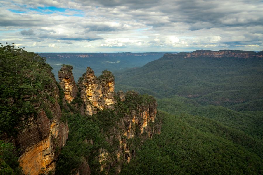
2. Echo Point & the Three Sisters~45 min at the stop
The Blue Mountains' signature lookout: three sandstone pinnacles from Gundungurra legend above an endless valley. A clifftop track links it to Scenic World.
Tip: The cliff track from Scenic World lands you here. Stand to the left of the main rail. The sisters read one by one from there.
Open on the map ↗↓ drive · 6 min · 3.2 km
3. Leura Mall~1 h 30 min at the stop
The mountains' prettiest street: cherry trees, bookshops, antiques and cafes. Dinner and the night's stay: here or in neighbouring Katoomba.
Tip: Lunch is at Cafe Leura, 180A Leura Mall, every day 8:00 to 15:00. That is not dinner: the kitchen closes at 15:00. Sleep in Leura or Katoomba. Book a Saturday table.
Open on the map ↗
Day 2: Blackheath & Megalong
Day in Google Maps ↗4. Govetts Leap lookout~30 min at the stop
A Grose Valley view many rate above Echo Point. With barely any crowds. Bridal Veil Falls drops in a thin ribbon to one side.
Tip: The main platform has a rail. Bridal Veil Falls shows after rain. Morning fog can swallow the whole valley.
Open on the map ↗↓ drive · 10 min · 5 km
5. Pulpit Rock (unfenced edges)~40 min at the stop
A narrow rock spur with a three-way lookout over the valley. Some edges are unfenced. Keep children to the main platform.
Tip: The edges are unfenced. With children, stay on the main platform. The rock is slippery after rain.
Open on the map ↗↓ drive · 25 min · 15 km
6. Megalong Valley Tearooms (est. 1956)~1 h at the stop
A winding descent into pastoral Megalong Valley. And scones with cream at tearooms pouring since 1956. The mountains' gentler, valley-floor face.
Tip: The tea rooms are now part of the LOT 101 estate (824 Megalong Road) and open daily 9am to 3pm. The famous scones with blackberry jam and cream are A$15; there is a 10% Sunday and 15% public holiday surcharge. The road down is steep and you climb back the same way.
Open on the map ↗
Day 3: Oberon & Mayfield
Day in Google Maps ↗7. Oberon town~45 min at the stop
A cool-climate timber town on the plateau beyond the ranges. In autumn people come for pine-forest mushrooming and golden poplars.
Tip: Fuel and coffee here, before the garden. In autumn the poplars along the streets are the view.
Open on the map ↗↓ drive · 10 min · 9 km
8. Mayfield Garden~2 h at the stop
One of the world's largest privately owned cool-climate gardens: water garden, obelisk, cascades. Allow at least two hours to walk it.
Tip: Price: A$38 / child A$17. Price is in the stop name. The garden opens daily 9am to 4:30pm, last entry 3pm, closed 25 and 26 December. Allow two hours and wear shoes for gravel paths.
Open on the map ↗↓ drive · 50 min · 56 km
9. Return via Mount Victoria~30 min at the stop
The way home over Victoria Pass. The convict-built 1830s mountain crossing. Coffee in village-like Mount Victoria before the descent towards Sydney.
Tip: Coffee in the village, then Victoria Pass. The pass winds. Daylight is easier than fog.
Open on the map ↗
Before you go
- Route times are estimates: walking, driving and a sensible pause at each stop. Add queues, traffic and swims yourself.
- Prices, timetables and trail status change. Check the venue's official site and the state transport app before you go.
- On beaches, swim only between the red and yellow flags. Use sun protection even when it is cloudy.