- Duration
- 3 days, ~320 km by car
- Who it suits
- Everyone
- Transport
- drive
- Start
- Tropical Fruit World (cafe free; farm tour ticketed)
- Finish
- Crystal Castle
- Pace
- moderate pace
- Best time
- June–November: humpbacks stream past Cape Byron and Norries Head
- Budget per adult
- Crystal Castle A$49.95 (child A$34.95); other stops are free, tours and tastings extraPrices as of: July 2026; transport and zoo prices October 2026
Getting there
Go by car. The Tweed Valley and Byron Bay sit beyond the tram.
Stops in order
The text version of the route: stops, time at each and the legs between them. Times are estimates, without queues, traffic or swims.
Day 1: farm, gin and the lighthouse
Day in Google Maps ↗1. Tropical Fruit World (cafe free; farm tour ticketed)~1 h 30 min at the stop
A plantation growing hundreds of tropical fruit varieties: the cafe and shop are free to enter, the farm itself is a ticketed tour.
Tip: The cafe's fruit-tasting plate is a quicker, cheaper hit than the full tour.
Open on the map ↗↓ drive · 10 min · 7 km
2. Husk Farm Distillery: home of Ink Gin~1 h at the stop
A distillery amid Tweed Valley cane fields: birthplace of the violet Ink Gin and Australian agricole rum.
Tip: Ink Gin turns from violet to pink with tonic: order it at the bar for the show.
Open on the map ↗↓ drive · 18 min · 16 km
3. Norries Headland, Cabarita~45 min at the stop
A grassy headland between Cabarita's two beaches: whales in season, surfers on the point break year-round.
Tip: The village cafes are two minutes' walk: a handy pause before the drive south.
Open on the map ↗↓ drive · 45 min · 43 km
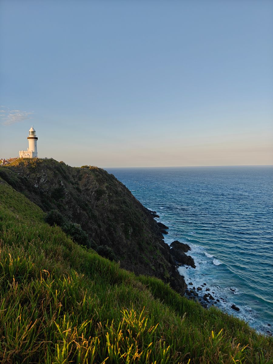
4. Cape Byron Lighthouse~1 h 30 min at the stop
The 1901 lighthouse on mainland Australia's easternmost point: Wategos' turquoise cove below, whales right under the cliff in season.
Tip: The lighthouse café has closed while its future is decided, so bring water and snacks. The lawn is open 8:00 to sunset, the maritime museum 10:00–16:00. Parking at the lighthouse is A$10 per hour, max one hour per vehicle per day.
Open on the map ↗
Day 2: Byron & Bangalow
Day in Google Maps ↗5. Byron Bay town & Main Beach~2 h at the stop
Byron in the morning: coffee on Jonson St, surf schools on Main Beach and the town's famously unhurried rhythm.
Tip: Central parking is paid and fills by 10am. Arrive earlier.
Open on the map ↗↓ drive · 10 min · 7 km
6. The Farm (free entry, 10am feeding)~1 h 30 min at the stop
A working communal farm: free-range pigs and hens, market gardens, a bakery and the Three Blue Ducks restaurant.
Tip: Time it for the 10am animal feeding: the farm's liveliest moment.
Open on the map ↗↓ drive · 10 min · 8 km
7. Bangalow village~1 h 30 min at the stop
Century-old shopfront verandahs, antique dealers and cafes on the main street. Byron's hinterland at its best.
Tip: On the fourth Sunday of the month the big market runs on the oval.
Open on the map ↗
Day 3: falls & Crystal Castle
Day in Google Maps ↗8. Minyon Falls (access via Minyon Falls Rd only)~1 h 30 min at the stop
The creek freefalls off a sheer rhyolite wall into Nightcap forest; the lookout sits right on the rim.
Tip: Nightcap Range Road is closed by a landslip until at least 31 December 2026, so the falls are reachable only via Minyon Falls Rd. Your GPS may suggest logging tracks: stick to that road.
Open on the map ↗↓ drive · 20 min · 11 km
9. Crystal Castle~2 h at the stop
Gardens of giant crystals and buddhas above the hinterland valleys: amethyst monoliths, a labyrinth and a teahouse.
Tip: Price: A$49.95 / child A$34.95. No timed sessions: it's a day ticket, last entry 16:00 (NSW time, an hour ahead of the Gold Coast in summer), and you can return free for 12 months with photo ID. Guided tour daily at 11:00, singing-bowl sessions at 12:00 and 15:00.
Open on the map ↗
Before you go
- Route times are estimates: walking, driving and a sensible pause at each stop. Add queues, traffic and swims yourself.
- Prices, timetables and trail status change. Check the venue's official site and the state transport app before you go.
- On beaches, swim only between the red and yellow flags. Use sun protection even when it is cloudy.