- Duration
- a day by car, about 250 km round trip from Cairns (≈ 5 h 6 min: moving and stop time only)
- Who it suits
- Everyone
- Transport
- drive
- Start
- Lake Eacham
- Finish
- Ellinjaa Falls
- Pace
- moderate pace
- Best time
- May to October; it is cooler up top than on the coast, bring a layer
- Budget per adult
- free apart from food and fuelPrices as of: October 2026
Getting there
By car only. Cairns to Lake Eacham is about 68 km up the Gillies Range, allow a little over an hour. Coming back down via Kuranda makes a loop.
Stops in order
The text version of the route: stops, time at each and the legs between them. Times are estimates, without queues, traffic or swims.
1. Lake Eacham~1 h 15 min at the stop
A crater lake in Crater Lakes National Park. A 3 km track circles it in about an hour, and you can swim from the edges.
Worth knowing: The lake formed more than 9,000 years ago in volcanic steam explosions. No stream flows in or out, so the level can shift by up to 4 m between seasons.
Tip: Swim at the edge, by the steps from the day-use area. A freshwater lake has no stingers.
Open on the map ↗↓ drive · 10 min · 7 km
2. Curtain Fig Tree~20 min at the stop
A strangler fig whose aerial roots hang down like a curtain. A boardwalk lets you see it from every side.
Worth knowing: The tree is over 500 years old, about 50 m tall, with a trunk circumference of 39 m.
Tip: At dusk, Lumholtz's tree-kangaroos sometimes show in the nearby trees; bring a torch.
Open on the map ↗↓ drive · 6 min · 4 km
3. Gallo Dairyland~1 h at the stop
A family dairy farm making its cheese and chocolate on site. BB's Cafe serves cheese platters with views over the paddocks.
Worth knowing: Founder Giovanni Gallo sailed 52 days from Italy to Cairns in 1927 and bought this farm in 1937; the dairy centre with its cheesery opened in 2007.
Tip: A handy lunch stop between the lakes and the falls. Check the hours by phone; the website only shows them as an image.
Open on the map ↗↓ drive · 35 min · 32 km
4. Millaa Millaa Falls~40 min at the stop
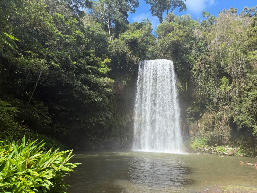
The most photographed waterfall on the Tablelands: an even curtain of water into a swimming pool, a couple of minutes from the car park.
Worth knowing: The falls are 18.3 m high. The name comes from the Mamu word 'malay malay', a rainforest vine whose fruit was a seasonal food.
Tip: The water is cold even in summer. This is the start of the waterfall circuit on Theresa Creek Road.
Open on the map ↗↓ drive · 10 min · 7.5 km
5. Zillie Falls~20 min at the stop
The falls 7.5 km on from Millaa Millaa, seen from a viewing platform above.
Tip: The path to the base is steep and slippery. With children, stick to the platform.
Open on the map ↗↓ drive · 5 min · 3 km
6. Ellinjaa Falls~25 min at the stop
The last falls on the circuit, 3 km further: water spills over basalt columns.
Tip: The steps down are wet, wear shoes with grip. Cairns is about 1.5 hours back.
Open on the map ↗
Before you go
- Route times are estimates: walking, driving and a sensible pause at each stop. Add queues, traffic and swims yourself.
- Prices, timetables and trail status change. Check the venue's official site and the state transport app before you go.
- On beaches, swim only between the red and yellow flags. Use sun protection even when it is cloudy.