- Duration
- 3 days: the cape, the south beaches, the hinterland
- Who it suits
- Everyone
- Transport
- walk, drive
- Start
- Main Beach
- Finish
- Bangalow
- Pace
- moderate pace
- Best time
- Thursday morning for the market, then the beach
- Budget per adult
- lighthouse parking A$10 per hour, 1 hour capPrices as of: 13 October 2026
Getting there
Ballina Byron Gateway is the closest airport, about 35 minutes by road. Book a shuttle ahead. Gold Coast Airport is the other common arrival, further north.
Stops in order
The text version of the route: stops, time at each and the legs between them. Times are estimates, without queues, traffic or swims.
Day 1. The cape
Day in Google Maps ↗1. Main Beach~40 min at the stop
The town beach by the centre. Clarkes, The Pass and the climb to the lighthouse continue east on foot from here.
Tip: Swim between the flags. Leave the car in town and you avoid the hourly cap at the lighthouse.
Open on the map ↗↓ walk · 18 min · 1.2 km
2. Clarkes Beach~25 min at the stop
The next cove after Main Beach, already closer to the cape track.
Tip: This is the place to peel off toward The Pass if the swell at Main Beach is too big.
Open on the map ↗↓ walk · 10 min · 0.4 km
3. The Pass~20 min at the stop
The beach and one of the entries to the Walgun Cape Byron track. Parking is A$5 per hour.
Tip: From here, continue on foot: the lighthouse car park is limited to one hour.
Open on the map ↗↓ walk · 25 min · 1.2 km
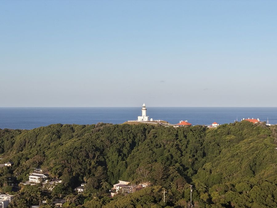
4. Cape Byron Lighthouse~40 min at the stop
The eastern point of the mainland. The lawn is open 8:00am to sunset, the museum 10:00am to 4:00pm.
Worth knowing: The light was first lit in 1901. At 2.2 million candela it is Australia's most powerful lighthouse, and its lens weighs about 8 tonnes.
Tip: No landing on Julian Rocks; view them from the lawn. The lighthouse café is closed, so carry water.
Open on the map ↗
Day 2. South beaches
Day in Google Maps ↗5. Tallow Beach~50 min at the stop
A 3 km beach in Arakwal National Park, only about 3 km from the centre yet far quieter than Main Beach. People come for long walks, beach fishing and whales in season.
Worth knowing: Arakwal National Park, behind the beach, was created in 2001 through an agreement between the Arakwal people and the NSW government, and the Arakwal now co-manage it.
Tip: It is an open beach and often without the town crowd. Read the surf yourself: there may be no flags.
Open on the map ↗↓ drive · 15 min · 8 km
6. Broken Head Nature Reserve~40 min at the stop
A headland reserve south of Tallow where rainforest runs down to the beach. The Three Sisters track climbs through the forest to a lookout over the sand, and the picnic area has barbecues.
Tip: Parking is A$4 per vehicle per hour, tap card or phone at the machine. Stick to marked tracks.
Open on the map ↗
Day 3. Brunswick and Bangalow
Day in Google Maps ↗7. Brunswick Heads~50 min at the stop
The small river town north of Byron: the bridge, the foreshore and the beach at the mouth.
Tip: Morning here is calmer than Byron. Eat by the river, then drive into the hills.
Open on the map ↗↓ drive · 25 min · 22 km
8. Bangalow~1 h at the stop
The main street of the hinterland. On Saturdays the market is in Piccabeen Park from 7:00am to 11:00am.
Tip: If it is not Saturday, the street still works: galleries and lunch. The market is Saturday morning only.
Open on the map ↗
Before you go
- Route times are estimates: walking, driving and a sensible pause at each stop. Add queues, traffic and swims yourself.
- Prices, timetables and trail status change. Check the venue's official site and the state transport app before you go.
- On beaches, swim only between the red and yellow flags. Use sun protection even when it is cloudy.