- Duration
- 3 days, ~300 km to the ferry and ~150 km on sand
- Who it suits
- Everyone
- Transport
- ferry, drive
- Start
- River Heads ferry
- Finish
- Champagne Pools
- Pace
- moderate pace
- Best time
- April–October: drier and cooler, and whales pass the coast from July to October
- Budget per adult
- vehicle permit A$61.80, return car ferry from A$270.60 + A$7 per person (plus accommodation and a 4WD hire)Prices as of: July 2026; transport and zoo prices October 2026
Getting there
About 3.5 hours' drive from Brisbane to River Heads near Hervey Bay. The Island Connections ferry takes about 50 minutes to Kingfisher Bay. From the south, a barge runs from Inskip Point near Rainbow Beach. Without your own 4WD, take a 1- or 2-day K'gari Explorer tour from Hervey Bay or Rainbow Beach.
Stops in order
The text version of the route: stops, time at each and the legs between them. Times are estimates, without queues, traffic or swims.
Day 1: the ferry and Lake McKenzie
Day in Google Maps ↗1. River Heads ferry~30 min at the stop
Island Connections carries vehicles and foot passengers to K'gari from here: about 50 minutes to Kingfisher Bay, about 30 to Wanggoolba Creek. Book ahead; tickets aren't sold on site.
Worth knowing: Permits no longer go on the windscreen: cameras on the island read number plates.
Tip: Check in 30 minutes before departure. Buy the QPWS vehicle permit online before the trip, you cannot buy one on the island.
Open on the map ↗↓ ferry · 45 min · 12 km
2. Kingfisher Bay~30 min at the stop
The resort on the calm west coast and the ferry landing. The sand tracks start here.
Tip: The resort roads are sealed, everything else is high-clearance 4WD only. Engage 4WD and lock the hubs before the sand.
Open on the map ↗↓ drive · 45 min · 15 km
3. Lake McKenzie (Boorangoora)~2 h at the stop
A freshwater perched lake in the dunes, fed only by rain, with shores of almost pure silica sand. The island's signature swim.
Worth knowing: It is a perched lake, sitting on a layer of compacted sand and organic matter 100 m above sea level and fed only by rain. The white beach sand is almost pure silica.
Tip: It is busiest 10:30–15:00. Bring only water to the shore, food and drinks are banned because of dingoes.
Open on the map ↗↓ drive · 30 min · 8 km
4. Central Station~1 h at the stop
The old forestry station in the rainforest. The Wanggoolba Creek boardwalk runs over perfectly clear water.
Tip: The short Wanggoolba Creek loop takes about an hour. Sleep at Kingfisher Bay or in a dingo-fenced campground.
Open on the map ↗
Day 2: 75 Mile Beach
Day in Google Maps ↗5. Eurong~20 min at the stop
East-coast settlement with fuel, a store and access to 75 Mile Beach. The beach is officially a road and an airstrip: give way to landing planes.
Tip: Drive the beach at low tide or within about two hours of it. The limit is 80 km/h on the beach and 30 km/h inland.
Open on the map ↗↓ drive · 35 min · 26 km
6. Eli Creek~1 h at the stop
The largest freshwater creek on the east coast: about 80 million litres a day run straight onto the beach. Walk up the boardwalk and float back down.
Tip: Keep children within arm's reach. Outside fenced areas walk as a group and carry a dingo stick.
Open on the map ↗↓ drive · 8 min · 4 km
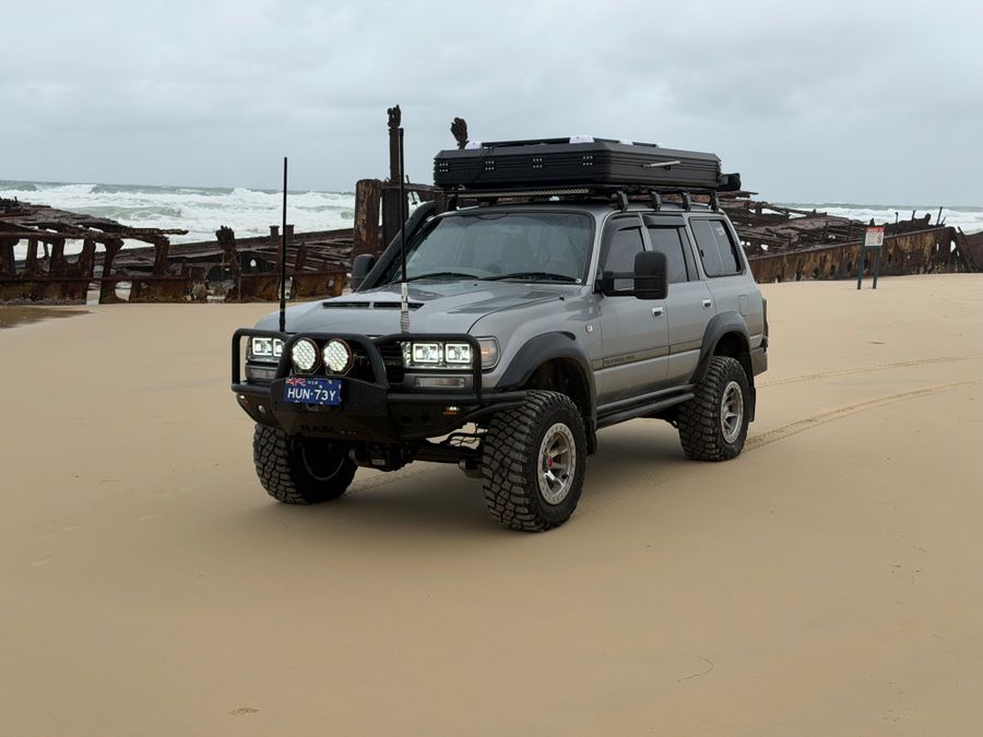
7. SS Maheno wreck~30 min at the stop
The hull of a 120 m liner built in Scotland in 1905. In WWI she served as New Zealand's hospital ship, carrying wounded from Gallipoli.
Worth knowing: In 1935 the retired liner was being towed to a Japanese shipbreaker when the towline snapped in a cyclone on 7 July; she was found beached on K'gari on 10 July. In WWII pilots and commandos trained on the hull, and today nearly three and a half decks lie under the sand.
Tip: Photograph from the sand and stay off the rusting hull.
Open on the map ↗↓ drive · 5 min · 3.5 km
8. The Pinnacles~20 min at the stop
A cliff of coloured sands above the beach, banded white to deep red. The colour comes from hematite, which stained and cemented the sand over thousands of years.
Tip: The light is best late in the day. Head back to camp before dark and with the tide in mind.
Open on the map ↗
Day 3: Indian Head and the ferry back
Day in Google Maps ↗9. Indian Head~45 min at the stop
A volcanic headland over the ocean, named by James Cook after he saw Aboriginal people gathered on it. Turtles, sharks and rays are often visible from the top.
Tip: The climb is short but rocky. Wear shoes, not thongs.
Open on the map ↗↓ drive · 5 min · 2 km
10. Champagne Pools~1 h at the stop
Rock pools where waves fizz over the rocks. The one saltwater swim on the east coast.
Tip: Swim at low tide in a calm sea. The drive back to the ferry is about 3 hours on beach and inland tracks, so leave well before the evening sailing.
Open on the map ↗
Before you go
- Route times are estimates: walking, driving and a sensible pause at each stop. Add queues, traffic and swims yourself.
- Prices, timetables and trail status change. Check the venue's official site and the state transport app before you go.
- On beaches, swim only between the red and yellow flags. Use sun protection even when it is cloudy.