- Duration
- 3 days, ~480 km, Hobart → Launceston
- Who it suits
- Everyone
- Transport
- drive
- Start
- Hobart → Sorell
- Finish
- Launceston
- Pace
- moderate pace
- Best time
- December–March for the warmest water; Bicheno's penguins show up at dusk year-round
- Budget per adult
- Lookouts and beaches are free; Freycinet National Park requires a parks pass (online or at the visitor centre)Prices as of: July 2026; transport and zoo prices October 2026
Getting there
Go by car. The east coast is a few days of driving.
Stops in order
The text version of the route: stops, time at each and the legs between them. Times are estimates, without queues, traffic or swims.
Day 1: to Swansea
Day in Google Maps ↗1. Hobart → Sorell~20 min at the stop
The Tasman Highway junction and the last big supermarket before the coast: fuel up and stock the picnic bag.
Tip: Fuel in Sorell. The east coast starts here, and the next proper station is a long way on.
Open on the map ↗↓ drive · 50 min · 54 km
2. Triabunna (Maria Island ferry)~40 min at the stop
A fishing port where the passenger ferry leaves for Maria Island: a sanctuary of wombats and convict ruins.
Tip: Even without the ferry, stop here. The Fish Van on the esplanade cooks fish to order. Maria Island has no cafe, so eat here.
Open on the map ↗↓ drive · 50 min · 55 km
3. Overnight Swansea
A 19th-century town on Great Oyster Bay: across the water rise the pink granite Hazards: the route's best sunset view.
Tip: Book a room facing east: sunrise over Freycinet comes free. By day, Kate's Berry Farm on Addison Street is open Friday to Tuesday, 9:00 to 16:00, kitchen until 15:15. Closed Wednesday and Thursday.
Open on the map ↗
Day 2: Freycinet
Day in Google Maps ↗4. Devil's Corner lookout~45 min at the stop
A cellar door amid the vines with a free lookout tower over Moulting Lagoon and the Hazards.
Tip: Drivers get coffee from the kiosk by the tower: same view as with a glass.
Open on the map ↗↓ drive · 30 min · 30 km
5. Coles Bay~30 min at the stop
The village at the foot of the Hazards and the gateway to Freycinet. Grab the parks pass and lunch supplies here.
Tip: This is the gate for Freycinet. Book a bed a long way ahead. Lunch on the way into the village is Freycinet Marine Farm: oysters, no booking. September to May the kitchen runs until 16:00, and in winter until 15:00. Still take water for the cape.
Open on the map ↗↓ drive · 8 min · 5 km
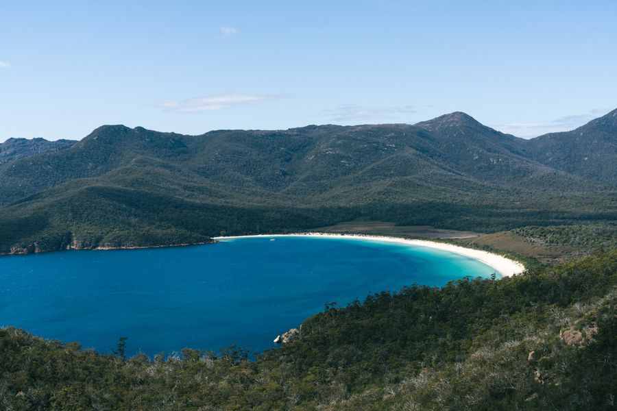
6. Wineglass Bay lookout (parks pass needed)~1 h 30 min at the stop
A climb up stone steps to the saddle of the Hazards: 2.6 km return, 1–1.5 hours, to the postcard view over the white curve of the bay.
Tip: Arrive before 10am: this trailhead car park fills faster than any in Tasmania.
Open on the map ↗↓ drive · 40 min · 41 km
7. Bicheno: evening penguins
A fishing town with a blowhole amid orange boulders; at dusk little penguins waddle home right by the village.
Tip: Book the evening penguin tour ahead, and never point a torch at the birds. Fish and chips are at Tasmanian Coastal Seafoods, 57A Burgess Street, next to the Log Cabin.
Open on the map ↗
Day 3: Bay of Fires
Day in Google Maps ↗8. St Helens~30 min at the stop
The east coast's fishing capital on Georges Bay: the natural base for Bay of Fires.
Tip: Restock here. The fish is at Skippers, on the wharf at Marina Parade. The coast beyond is quieter, and dinner may be whatever you bought.
Open on the map ↗↓ drive · 15 min · 12 km
9. Binalong Bay orange boulders~1 h at the stop
The Bay of Fires signature: granite ablaze with orange lichen, white quartz sand and turquoise water.
Tip: Best light is early morning, when the sun hits the boulders from the sea.
Open on the map ↗↓ drive · 15 min · 11 km
10. The Gardens~45 min at the stop
The near-empty northern end of Bay of Fires: the same orange headlands, minus the crowds.
Tip: The bay is short and granite. Part of the road is unsealed. Leave while it is still light.
Open on the map ↗↓ drive · 2 h 30 min · 170 km
11. Launceston
Route's end: Tasmania's second city, with Victorian streetscapes and Cataract Gorge a 15-minute walk from downtown.
Tip: From here, roll straight into the North and Cradle Mountain route. Lunch and dinner are at Stillwater, in the old mill by the gorge: Monday to Saturday, lunch from 10:30, dinner from 17:00. Closed on Sunday.
Open on the map ↗
Before you go
- Route times are estimates: walking, driving and a sensible pause at each stop. Add queues, traffic and swims yourself.
- Prices, timetables and trail status change. Check the venue's official site and the state transport app before you go.
- On beaches, swim only between the red and yellow flags. Use sun protection even when it is cloudy.